Monday, July 21, 2014

Day Thirty Two - Travel to BMW MOA Rally in the Twin Cities

So, here we are on Day 32 - less than a days ride to the BMW MOA Rally in the Twin Cities. We had planned on getting there all along but it isn't simple to plan exactly how long it will take to ride 11,000 miles. There are so many variables but we did pretty good. We will be arriving 2 days earlier than planned.

This morning, we slept in until 6:15 AM We did our usual routine and were almost ready to go by about 8:15 AM. It was then that I realized that I did not know where my wallet was. I didn't see it in the room when I did my usual final scan to make sure I didn't leave anything behind. Then I got to thinking maybe it was still in my pants pocket from the evening before so opened my bag and pulled out the pants - no joy. I now started searching every piece of luggage on the bike and still no joy. Now I had to go get another key for the room and I searched it again. Finally, as I was pulling the curtains aside to see if I had left it on the window sill, I spotted it on the floor where it had been obscured by the curtains.Whew!

 Back at the bike I re-packed everything and we pulled out at 8:31 AM. It was warm, with the temp at 72 and looking to be a really nice day. We headed eastbound on US-10 which would be a 110 mile leg over to Motley MN where it would turn into Hwy 210.

Day 32 track

The road was  nothing remarkable. Just a standard 4 lane divided highway mostly, except when going through some towns/cities where it would collapse into a two-lane undivided road for some distance before opening up again. I do get a kick out of seeing the town signs which usually list the population. Some in the tens of thousands to one I recall this morning of 48.  After about 45 minutes on the road we noticed darkening skies ahead and by the hour we ran into a bank of fog which was a mixed blessing. On the one hand, it kept the sun from heating the air much so it made for comfortable riding. On the other hand was the potential threat of turning into rain.

Foggy - but will it rain?
Larry's XM Weather did alert that there was rain "in the area" but when he checked the radar it was to our north. Soon enough though we were seeing wet roads, meaning it had rained recently. Despite all that we eventually ran out from under the fog/clouds and into a sunny, albeit hot late morning/early afternoon.

Since we only had 250 miles to make today, we were trying to string it out so we wouldn't arrive so early at the hotel that they wouldn't have any rooms ready yet. We made a coffee break stop at the 106 mile mark in Staples, MN where we would manage to blow off about 40 minutes at a Burger King.

Back on the road we continued down US-10 through Motley where 10 turned south so we continued easterly on 210 which would take us down through Brainerd, MN (and our first crossing of the Mississippi River) where we would then pick up Hwy 18 to take us over to Mille Lacs Lake where 18 joined US-169 and snaked along the lakeside for 15 miles or so.

Mille Lacs Lake from US-169
This is a pretty large lake as you can see from the above photo. Though the day was heating up, it was nice and cool along the lakeside with the wind coming off the water. That didn't last too long though. Soon, we were heading south and away from the lake. The sun was getting high, the clouds all gone and the temps climbing.

We would stop for lunch in the town of Becker, MN at a place names "Cafe Pawz". It turned out to be an very upscale cafe located inside a HUGE furniture store. Quite interesting, though I didn't get any photos.

We were only about 10 miles from our destination of Monticello, MN where we will be staying for two nights before the start of the BMW MOA Rally when we will change hotels to a Twin Cities suburb of Roseville for the duration of the rally.

Here in Monticello is a motorcycle dealer (Moon Motorsports) where we will be getting oil changes, tire changes and cleaning up the bikes from the 5 weeks on the road. For the duration of the rally we will be putting our Team Strange Grand Tours on hold. Therefor, I won't be updating this blog again until the end of the rally and we start up the tours again - unless I win a bike at the rally in which case I might make an exception ;-)

Today's Stats: 244.5 miles in 6:30 elapsed time, 4:28 saddle time.

Tour Stats to date:

32 consecutive days on the road, covering 10,936 miles in 204 hours of saddle time.

TS30GT Tour to Break


Sunday, July 20, 2014

Day Thirty One - More Presidents and IBEW

Well, I guess we need to work on our time zone acclimatization. We slept in until 6:45 AM! It did feel good, but we have places to go and photos to take so we hustled out to load the bikes and then grab a quick breakfast at the hotel. It was 70 degrees when we left so for a second day we didn't need any additional layers to start off the day.

As you can see from the track below, we headed east in I-94 for about 20 miles before turning northward onto Hwy 14 for an 83 mile leg. It was a very pleasant ride on this two lane road with practically no other traffic. It wasn't twisty at all, though it did undulate up and down enough to make it less boring.

Day 31 Track

Here's the elevaton progile to the entire day. You can see the spikes in the first 80 miles.

Day 31 Elevation Profile
From a scenery standpoint, it was very much like the day before. Maybe a little less hay and a bit more other crops and farm animals, but that was about the extent, at least for the early morning.I took this shot behind me at about 8:00 AM - Look closely and see how bone-straight the road is here...

Straight as an arrow!
As we ran up Hwy 14, we were thinking about a break, but the GPS showed absolutely NOTHING for food along the route. We rolled into a little town called Annamoose hoping maybe there would be something there - there was one bakery/cafe, but it was closed for the day! Also here at Annamoose, the road changed from Hwy 14 to CR-11 - a bit narrower road which would take us up to our turn onto Hwy 19.

Our first waypoint would be the Pierce County line, which wasn't exactly where we expected it to be - which was right at the turn from CR-11 onto Hwy 19.  When we got to where we had it marked on the GPS, it wasn't anywhere around. After checking and re-checking the GPS and Larry's paper maps, we had resigned ourselves that we would have to figure out something else for this one and we headed on eastward on 19. It wasn't about 2 miles when I spotted a county sign - an voila, there it was! There was NO WAY to pul off the road for the photo, but we only saw one other car go by while we were getting our photos.
Presidential Tour - Pierce County
This is what 107 miles of riding in the farm country does to your face shield. This is part of the reason we wear face shields! Nothing a quick wash & wipe can't take care of.

Have to clean face shield every stop!
From here we are continuing east on Hwy 19 which we will take for another 50 miles over to US-281 which is also the west end of Devils Lake. We are still looking for a snack but the GPS only shown one place in Minnewaukan so I add it to our route. When we get there, we have run 152 miles without any breaks other than the 4 minutes we spent getting the Pierce County photos. We pull up to the below scene. Its NOT open, so Larry breaks out his backup plan - some granola bars and we take a quick break.
No lunch here today!
We don't dally there though and we are back on the road on US-281 (which is also still Hwy 19) and in just a mile or two we are turning eastward again on 19 crossing over parts of Devils Lake. This is a really pretty big lake! (Click on the underlined text for more info). Here is one photo I took from the saddle.

Devils Lake as we cross over part of it
Its another 12  more miles into the city of Devils Lake, which is our next waypoint. Even though we are still looking for coffee, we head to the post office to take care of business first.

I've Been Everywhere Man - Devils Lake
Right after the Devils Lake post office, we head to a nearby McDonalds for that overdue coffee break. It's now 11:49 AM, but Larry isn't quite ready for lunch yet so we head back out on the road expecting to catch something another hour or so later. Before we do though we get caught up in chatting with a couple who are just getting out of their car as we are getting to the bikes, and chat them up for some time. We even got an invitation to a fish fry which we had to beg off on. Our coffee break ends up taking 45 minutes!

From here we are now heading east on US-2 which will be another 60 miles to Hwy 18 just north of Larimore ND. We've  both been across US-2, together most recently when we did our USA 4 Corners Tour. It's a nice 4 lane divided highway but not an interstate. There are towns along the way, (Michigan, Petersburg & Niagara) but we have already picked out a lunch spot in Larimore so that's where we head. When we get there, the place shown in the GPS turns out to be a bar and the only food they have is pizza which isn't thrilling Larry, so we turn around and got to a little diner we saw on the way into town. It isn't anything fancy, mostly fried food and the church crowd is in there so we are in for a long wait for our lunch. It turned out to be an hour before we would get rolling again.

From there we were headed down Hwy 18 for another 27 miles to get to our next waypoint - the town of Hatton ND which will give us the "h" in Team Strange Airheads"

Hatton - The "h" in Team Strange Airheads
Continuing down Hwy 18 for another 10 miles where we turn eastward onto Hwy 200 which will take up over to I-29 which we will take south down into Fargo. We were expecting to make our hotel tonight on the one tank of gas, but I am not convinced I will make it the whole way. Each gas station I pass I get more concerned about making it so finally, when I spot a station with gas for $3.49 I decide to relieve any stress by filling there. I am really glad I did too, because when we got onto I-29, the speed limit is 75 and we have a bit of a headwind so I am sucking fuel to the tune of 38 MPG or so and under those circumstances I most certainly wouldn't have made it all the way in. Too bad though because when we got into Fargo there was gas to be had for as low as $3.34 a gallon!

Once in Fargo we are headed for the post office only to be denied once again by a huge "Federal Building/Post office with NO city or state name references anywhere on it! This is like the 3rd or 4th of these... So, plan B - The police station, which is a couple of blocks away. Better luck here.

I've Been Everywhere Man - Fargo
We are almost done for the day. Just one more waypoint before our hotel - The Minnesota State border sign. We are on city streets now and when we get to the border as marked by my GPS there is nothing to be found. Larry says its OK, because the border is actually the river just up ahead. Well,we get across the river and still no sign... We continue on in the direction of our hotel and about another 3/4 miles we suddenly see the State Border sign!

I've Been Everywhere Man - Minnesota
We're just minutes from the hotel now and it's been a long day. And it's up to 94 degrees so it's pretty hot too. I am really looking forward to that 16 oz. Budweiser that's in my cooler....

Today's Stats: 349.1 miles in 8:37 elapsed time, 6:03 saddle time

Saturday, July 19, 2014

Day Thirty - Presidents Day

Today was to be another shorter day so we really did sleep in a bit, not arising until 6:30 AM. We loaded up then got a decent breakfast and hit the road at 7:45 AM. The temp was 66 degrees so I went without any extra gear, though Larry stuck with his liner. We headed down through downtown Sturgis and once out of town we turned north on Hwy 79 for what would be a 133 mile leg.

Day 30 Track
On the way out of town we saw a a lot of accomodations for the rally bikers. There was a huge place with what looked to be 50 or more cabins, and after we turned on 79 even more places advertising camping spaces. Even at 10+ miles out there were still some bars and inns catering to the motorcycle crowd, so it IS a big thing for the town. Here's what the road looked like after we started up 79.

Bear Butte ahead
The terrain didn't vary much all morning. It was lots of fields, often covered in hay or hay bales. The elevation "rolled" a lot, but overall we were in an all day descent that would see us drop for 3700 ft where we left to 1750 ft when we arrived in Bismarck ND at the end of the day. Along the way we did spot several pronghorn antelope - well off the road. This next photo taken looking behind me it typical of what we saw much of the day.

Check out all the bales of hay!
It would be 67 miles - about an hour and twenty minutes before we would make our first stop - for a scheduled waypoint - The Harding County line for our Presidential tour. 

Presidential Tour - Harding County line
Not too long after the county line photo (about 10 minutes), we could see hills in the horizon - and here the terrain would change noticeably. The hills in this photo are contained in the Custer National Park.

Custer National Park ahead
And here is yet more hay...

Hay and more hay
By now we are getting itchy for a coffee break, but GPS searched ahead aren't encouraging - showing nearest food of any kind is 70 miles ahead "as the crow flies" meaning it could be more like 90 miles...
70 merges with 20 for a short bit to jog eastward before splitting off north again. We had hopes that the town named Reva might have something just not listed in the GPS, but it was little more than a post office so we kept on. Eventually we arrived at the ND border where we were supposed to find the Adams County line, but there was no county sign - only the state border sign. Fortunately, our resident master navigator Larry was able to reference his paper maps and see that if we went off route to head west on US-12 we might pick up the western border of Adams County and that's exactly how that worked out. You can see this on the track photo - its that little left incursion towards Gascoyne on the map.
Presidential Tour - Adams County
 It was now 10:30 AM and we'd ridden 144 miles with essentially no break so we were ready. GPS still showed 40+ miles to nearest food so as we rolled eastward again, we decided to take a chance and get off the route and into the little town or Reeder ND to see if there was anything there. As we headed down into town it did not look promising. But we persisted and after a couple of turns we spotted a Bar/cafe and it appeared to be open so we parked and went in. There were a couple of locals sitting at the bar, one drinking coffee so that was promising. We sat at a table and the bartender came over with menus. It wasn't on the menu but Larry asked for an egg sandwich and we each got a coffee. We chatted with the locals while enjoying the coffees and Larry got a decent sandwich. We spent just about a half hour here before moving on.

After another 25 miles northbound on Hwy 21 - much of it behind a semi hauling pipe, we turned eastward om Hwy 22. Even though Larry had his egg sandwich, I hadn't eaten anything since breakfast and lunchtime was approaching with very limited choices ahead. I radioed to Larry that there was a diner listed in the town of Mott ND which was then about 12 miles ahead so we decided to try that. Shortly before the town, I saw Larry's brake lights come on as he veered to the right. I braked also and spotted the problem - it was a hen pheasant that had been in the opposite traffic lane, but when Larry came up on her, she ran towards the right. I don't know how, but she managed to escape undamaged, but not by more than a feather's worth! When we did get into Mott the Pheasant Cafe & Lounge turned out to be a diner on on side and a bar on the other. We did manage to get a reasonable lunch from a fairly limited menu.We were in and out of here in just 30 minutes. That may have been partly due to the fact that it was freezing cold inside. Larry even kept his motorcycle jacket on!

Back on the road, it was more of the same - Fields of hay and now we were starting to also see some corn and even some dairy farms too.

Yet more Hay!
 We were still on Hwy 21 here and this shot looking back showed a nice contrasting field of yellow on one side and green on the other. Not really sure what the fields were but they looked pretty!

Contrasting fields of ???
Eventually we got to our next waypoint - another county line.

Presidential Tour - Grant County
Shorthly after the above photo we were supposed to head north to pick up I-94 into Bismarck, but we decided to stay on 21 eastbound so as to avoid the interstate. We did run into a paving operation with a one lane road restriction but even with the 5 minute wait there we were still happy to skip the interstate. Oh yeah, somewhere along here we crossed back into Central Time thus "losing" an hour.

We arrived in Bismarck at 3:30 PM local time. Still an early day.

Today's Stats: 303.2 miles in 6:47 elapsed time, 5:23 saddle time


Friday, July 18, 2014

Day Twenty Nine - Mt Rushmore

As we draw closer to Minneapolis MN which is where we will be spending 4 days at the BMW National Rally we have calculated out ahead and are running ahead of schedule. That is why we have been scaling back on the miles per day - to ensure we don't get there too early. For that reason, today we only scheduled 280 miles to get to Sturgis, SD. That means we don't have to leave at the crack of dawn, though it's hard to sleep in. Our hotel did serve a cold breakfast so we wouldn't need to stop as on some previous days. This morning was also a bit warmer than yesterday with 64 showing before we left.

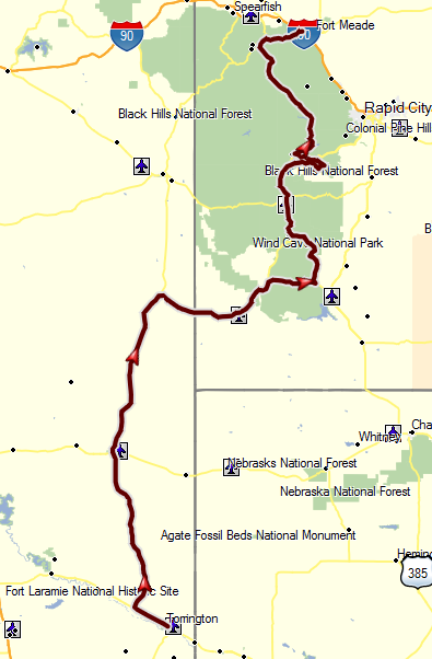
Day 29 Track
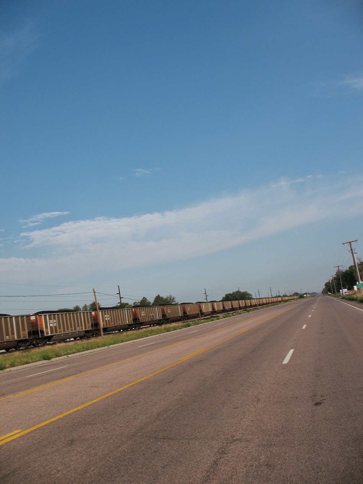
We headed out from the hotel on US-26 northwesterly at 7:38 AM. It would be a short hop over to US-85, but we did see an incredibly long coal train headed east before we got to US-85.

Coal Train - goes on and on and on...
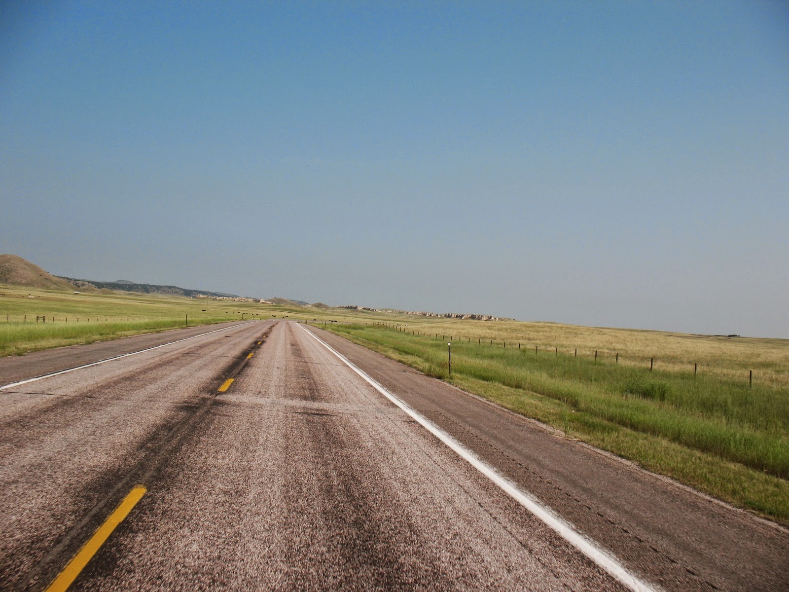
US-85 would be a long run - just short of 100 miles to our next turn. It wasn't twisty at all, and the elevation did climb from a little over 4200 ft at the start to a peak of 5170 and then back down to 4200 ft again by the end. So, it wasn't a particularly "fun" motorcycle road, but it was a pretty ride. Nothing "spectacular" as in the Rockies but mile after mile of rolling fields of amber grain, punctuated by rocky mesas made for pleasant views all along the way.

US-85 south of Lusk, WY
We did stop in Lusk WY, which was about half way of the US-85 leg. We needed to shed a layer of gear and we got coffees and killed some time so we wouldn't get to our hotel for the evening before check-in time.

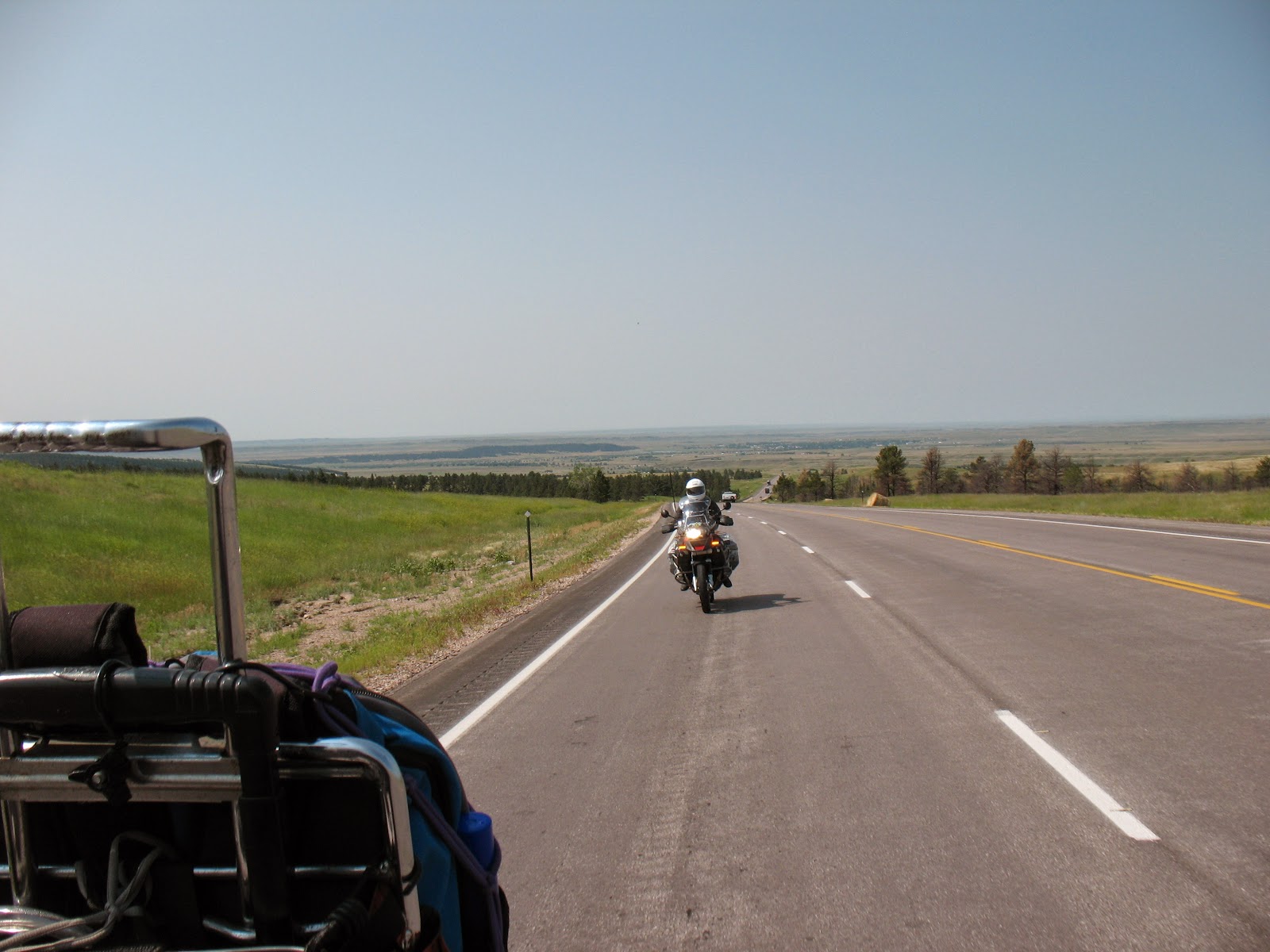
It was 10:00 AM when we made the turn eastward onto US-18. This would bring us over 10 miles to cross the border into South Dakota and into the Black Hills. I got this photo over my shoulder looking back.

Leaving Wyoming
We would take US-18 all the way into Hot Springs SD.We actually missed our turn onto 89, but Larry wanted to make a stop in town so we went there. From there we worked our way through town and then on to 385 which would take us through the Wind Cave National Park, and ultimately back onto 89. I really hoped to get photos of the bison through the park, but they only appeared for a very short few seconds and well off the roadway so I couldn't get the photo. Eventually, we made our way up to Mt Rushmore, which would be our only waypoint of the day - for the Presidential tour. The road got tighter and twistier on the way in, but there was too much other traffic on it to really enjoy from a riding perspective.

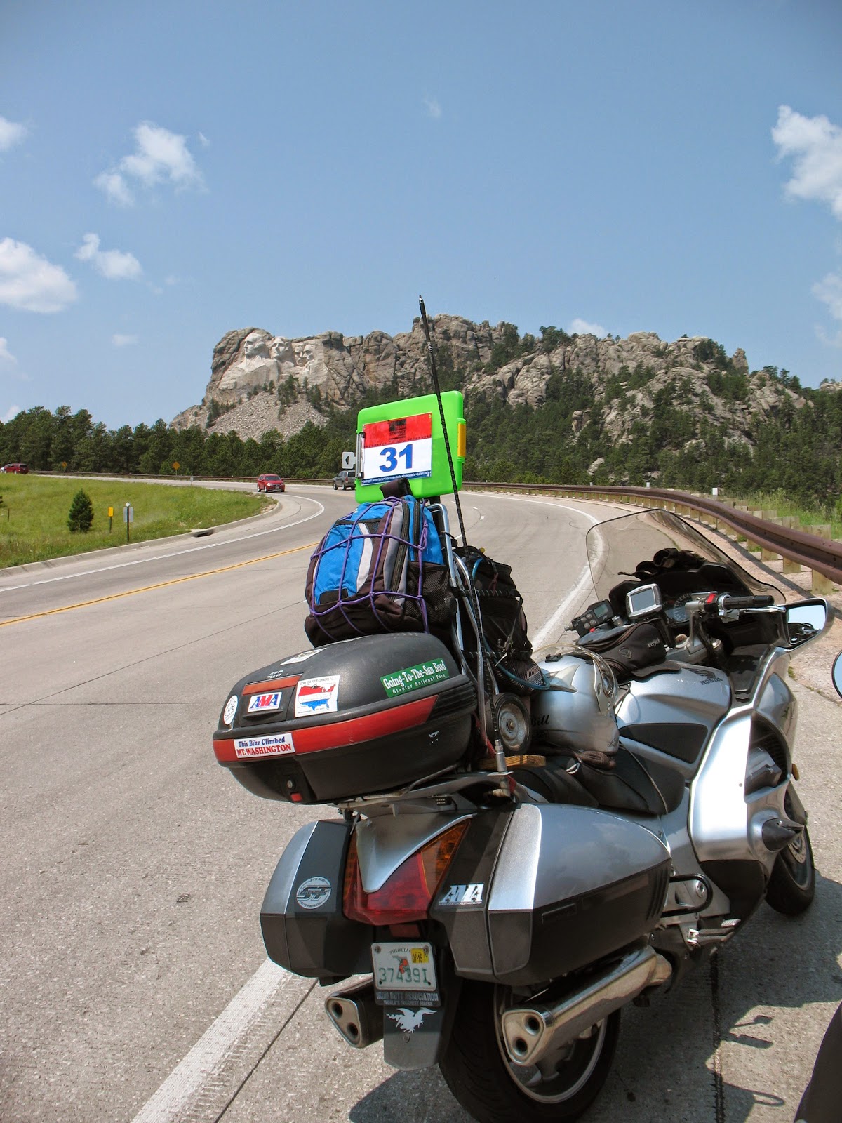
Presidential Tour - Mt Rushmore
We stopped in Keystone SD for lunch and then took a short twisty back road that Larry knew about and in an effort to kill some more time. From there is was US-385 all the way up to Deadwood where we would turn onto US-14a to get us over to Sturgis. We did see a lot of Corvettes around, like probably over 100 so there must be a Corvette meet somewhere.

We got into our hotel in Sturgis at 2:03 PM! I was surprised they had a room ready, but they did. This gave us time to do some laundry, do some more washing and cleanup on the bikes and take a bit of a break before getting out for dinner.

Today's Stats: 270.8 miles in 6:28 elapsed time, 5:08 saddle time

Thursday, July 17, 2014

Day Twenty Eight - Travel Day, Poudre Canyon

We stayed at another hotel with no breakfast service, so once we were awake at 6:10 AM, all we had to do was load the bikes and go. It felt "cool" when we first started to load so we turned on the tube and heard a weather report that Grand Lake (which we visited yesterday 25 miles away) was reporting 32 degrees! I could hardly believe my ears. I checked the thermometer on the bike and said 48 degrees, so it was cold. As a result, I donned my heated liner and my rain jacket. We were rolling at 6:47 AM.

Day 28 track
It was very foggy, though initially the fog was a couple hundred feet off the surface. As soon as we got rolling, the temp dropped from 48 down to 41. The photo below is a little blurry due to the lack of light because of the fog. We would run a few miles on US-40 back towards Granby before making the turn northward on Hwy 125.

High fog right after start of today's ride
The photo above was taken 16 miles after we started the day. We are on Hwy 125 at 8460 ft of elevation and climbing up towards Willow Creek Pass. It;s now 41 degrees and I haven't yet turned on my heated liner, but I DO have my grip heaters set on medium-low. Soon after this we ran up into the fog and it was "pea-soup" for a while. Between the poor visibility and the twisty road I couldn't manage any photos while riding. Shortly before we got to the Willow Creek Pass, we rose above the fog bank and into the sunny skies, but the temps had dropped to 37 degrees. I clicked on my heated liner and it felt good. At the 28 mile mark since we started we crested Willow Creek Pass at 9,659 ft. We also crossed the continental divide again. From here we would begin a descent of 1500 ft which would take another 30 miles. For a while it was cold, but clear as the next photo shows as we run across some new pavement not yet finished in the opposite lane. We did come across a big fat woodchuck near the edge of the road, but he scampered back into the woods as we swooped by.

In the clear after crossing Willow Creek Pass
We were hoping it would be clear like this the rest of the day, but that was not to be. Another 10 minutes down the road we ran into this. Note the line of clouds formation off to the left in this photo.

Fog is back and thick!
 At this point we are just trying to stay on the road, hoping no deer, moose or other critters cross the road, and stay warm. We know there is a restaurant waiting ahead for us in Walden, so we're intent on getting there for breakfast. Not far after this photo we came across a couple hundred foot stretch of road with heavy deposits of HAIL along the sides! I couldn't get my camera out quick enough to catch that.Finally, at just before 8:00 AM we reached Walden and our oasis in the cold - The Moose Creek Cafe.
Moose Creek Cafe - with local ranchers hanging out on the front porch
Here's a menu item you don't see very often - certainly not back east -

Rocky Mountain Oysters
We got breakfast and lots of coffee and sat a while hoping the fog would clear. It did lift a bit, but after nearly an hour we decided to press on. We are now heading out on CO-14 which would turn out to be the STAR of the day. 14 would take us up into the Roosevelt National Forest, and then over Cameron Pass (10,276 ft).
On the way up to Cameron Pass
This whole stretch approaching Cameron Pass was very scenic with lots of evergreens, silhouetted against the rugged mountainsides and the blue skies with puffy white clouds it was just beautiful. Unfortunately the wi-fi at this hotel is so poor I cannot post as many photos as I'd like...

The descent down from Cameron Pass was equally as scenic and twisty in places as well so it made for a really sweet ride.

CO-14 descending from Cameron Pass
At this point, we are now entering Poudre Canyon (pronounced "poo-der") and the road will snake along with the Poudre River as both descend into the canyon. It gets steeper and twistier for a while, and even has a waterfall for the river which we didn't stop to photograph. I mean, the splendor is so great that if we stopped for every photo opportunity we'd never get anywhere! I am trying hard to catch photos of the river to the side of the road, but every time I pull the camera out, the river splits away from the road or the vegetation obscures it. When holding the camera with my left hand so I can take a photo, I cannot operate the shift lever so I can't just keep the camera out the whole time. Eventually, I get tired of the cat and mouse game and Larry is getting warm so we stop to shed a layer and I get this photo of the Poudre River.

A quiet section of the river
Eventually I do manage a shot of the river from the saddle and the river is running pretty good here.

Poudre River alongside CO-14
The road continues along the river and through an ever narrower canyon in places making it twistier and more exciting. Fortunately for us there is very little traffic so we are able to enjoy the majority as we like. We did stop in a few places and took pictures, including a group of rafters coming down a rapids.

Rafting - very popular here!

We finally reach the northern limits of Fort Collins where we make our way across city streets over to I-25 which we get on headed north. Here is our last look at the Colorado Rockies as we head north in I-25 towards Wyoming.

The Rockies from I-25 north of Fort Collins
We had seen oil pumps before, but not for a few days so here was one shortly after we got into Wyoming on I-25.

Oil Pump in the field
From here we would head on up I-25 through Cheyenne, and then a few miles north of town turn onto US-85 for the last leg on up to Torrington Wyoming. We made a stop at a rest area where we chatted up a trucker, Bob, who was envious of our trip. I hope we convinced him to retire and go for it! Had more pictures but cannot post due to poor internet.

Today's Stats: 281.5 miles in 8:11 Elapsed time, 5:14 saddle time.


Wednesday, July 16, 2014

Day Twenty Seven - Colorado, Grand Lake, Eisenhower Tunnel + Berthoud Pass

We got a really good nights sleep - sleeping a bit late to 6:30 AM. When we went to load the bikes, the covers were damp and it was pretty cloudy so the chances of rain appeared quite good. We finished loading with a few sprinkles then had breakfast, got gas and hit the road at 7:40 AM. It was 51 degrees so we both had an extra layer on, mine being my rain jacket - just in case.

Day 27 track log
Our initial leg was a 20 mile pull east on I-80. As we merged onto I-80 from the ramp we could see the rain clouds heavy ahead. I knew we'd be turning south and away from the rain in 20 miles, but wasn't at all sure we wouldn't run into the storm first. Here was the view we had heading down I-80.

I-80 eastbound from Rawlins, WY
The closer to the exit we got, the worse it looked. We finally made the exit, and here's a photo I took just after we got onto Hwy 130.

How do you spell close?
Note the wet road and the rain off to the left on the photo above. I can't believe we were once again so close yet get off without getting wet! We would continue south on 130 for 37 miles to get to our first waypoint for today. Encampment, WY - the "e" in Airheads for the Team Strange Airheads 30 tour.

Encampment, WY - The "e" in Airheads
From here, we would continue on Hwy 230 for another 28 miles to get to the Colorado Border for our I've Been Everywhere Tour. The road so far was unremarkable. Mostly straight, very sparsely traveled with OK scenery, but nothing really spectacular.

I've Been Everywhere Man - Colorado
Ever since we left the hotel this morning, I have only had sound in one ear. While we were stopped at the border, I managed to trace the problem down to a broken wire in my main J&M harness. Nothing I can do about it for now, but in the evening I can access the passenger cable and use that for a temporary fix.

Here's a perspective - The view from the border back into Wyoming

View back into Wyoming
And the view ahead into Colorado

View ahead into Colorado
Just 10 more miles down the road we would turn southwesterly onto CO-127. I got the following shot from the saddle - behind me.

Southeast bound on CO-127
Thirteen miles further down the road we would come into the town of Walden and we spotted a cafe with a bunch of locals sitting out front so we pulled in for a coffee break. I didn't get any pictures but we liked it enough that since tomorrow's route comes back this way we might make it our breakfast stop. We blew off 40 minutes here and I shed my rain jacket, even though the temp was still only 56 degrees. It wasn't warming up very fast this morning, but maybe that's because we have been steadily gaining elevation and are now at near 8,000 ft.

From Walden, we would head out still southeasterly on Hwy 14. Now, 14 wasn't too spectacular - it was pretty straight, at least on this stretch of it, but it did roll up and down some hills at the photo below shows.

Hwy 14 out of Walden CO
We would run 32 miles on 14 to get us down to US-40 but as we got down 14 it started to get to be more fun with some nice sweeping turns as it meandered its way to meet up with US-40.

At US-40 we would turn southerly for another 30 mile run down into Kremmeling. This road had a bit more character than 14 did and we enjoyed it some until we got stuck behind a pickup towing a trailer who held up a line of 8 vehicles, including us - for several miles. Eventually, we managed to pick them off one by one and finally work past the trailer who appeared to have absolutely no clue. Oh well, picking them off was more fun than staying stuck behind! By the time we got by the trailer, the road had straightened out some and I got this photo shot from the saddle to my rear.

US-40 - about 6 miles north of Kremmling CO
By the time we rolled into Kremmling, I suggested to Larry that maybe he wanted to remove his liner - since he didn't take it off back in Walden. It had finally risen in temperature all the way up to a whopping 60!

From here we headed out of town south on CO-9 for another 37 mile pull which would get us down to I-70 so we could go for the Eisenhower Tunnel. Here's a shot I took shortly after getting onto 9 out of Kremmling. Note the skies...

CO-9 - south of Kremmling CO
CO-9 was like much of the roads today, but maybe a bit more congested. It did take us through the Arapaho National Forest. One thing I forgot to mention about all the roads today so far in Colorado - the prarie dogs - little creatures ranging in size from as small as a chipmunk to as large as a small squirrel - darting across the roads and playing russian roulette with any vehicles happening to be running by at the time. I don't think I hit any, but there were a few close calls. And, there were plenty of their not so lucky friends who hadn't made it littering the road. Maybe that's what this hawk we saw was chasing as he swooped in from the left directly in front of the pickup in front of me. The hawk nearly got hit by the pickup, but managed to veer up and back to the left just in the nick of time. After all this excitement, we rolled into Silverthorne and since it was noon local time decided to hit a cafe for lunch. I found one right on our route and just a quarter mile before we would turn onto I-70.

After a hearty meal of homemade chicken & rice soup and a half club sandwich (Larry had the soup without the sandwich) we mounted back up and got onto I-70. We had about an 8 mile run to get the the twin tunnels. We really weren't sure exactly what our options for stopping to get photos would be so we approached the tunnel entrances from the slow lane. Fortunately the traffic wasn't so heavy as to force us into approaching too fast. We did find a pull of area just near the entrance and stopped to set up to take our photos. Some DOT guy appeared out of nowhere to see if we needed assistance. We told him what we were doing and he offered to take the photos for us!. It wasn't an ideal set up as the tunnel we needed was the Eisenhower - which is the norther side tunnel and we were on the southern side of the road - nearer the Johnson Tunnel entrance. You can however see the tunnel name if you look at the photo closely. That's also why I made this photo full size.

Presidential Tour - Eisenhower Tunnel Bonus
After the photo we went through the Johnson tunnel and the road after that was very rough in spots. In fact, there had been a warning sign before the tunnel entrance for motorcycles to use the left lane because of road damage. We had run over some wet road leading up to here and more as we exited the tunnel. There clearly was some rain in the area, but we continued to be lucky to not actually be where it was at any given time. We continued up I-70 towards our exit to get onto US-40 again - only this time we would be heading north. There was an ominous dark cloud off to our left that I was sure we were finally going to face...

As we headed up US-40 from I-70 here's a shot I got showing what we were looking at.

US-40 northbound from I-70 and Empire CO
It REALLY looked like we were going to find a way to run into this storm! As we headed up this road (US-40) we were starting a climb that would take us up across Berthoud Pass at an elevation of 11,353 ft. We were already at 9500 ft when the photo above was taken. Here's what the track looks like for this section of the ride.

Track for Berthoud Pass crossing
 In addition to the squiggly lines that fold back on themselves a number of times, also note how we would be heading almost dead west and then turn sharply north...

When we got to the top of Berthoud Pass here's what it looked like.

See the dark clouds - now BEHIND us!
 My God how can we be so lucky, We were headed right into that storm, but then the road turned us out of it at the very last second!

Been There - Done That!
 And now for the descent down the other side Here's what the road down looks like from the peak.

Zoomed in so you can see the road winding down the mountain
And here's what the elevation profile of this pass crossing looks like.


The profile above covers from where we got off I-70 onto US-40 and goes all the way to Winter Park. The track shown as "Track for Berthoud Pass crossing" shows about 5 miles less than this profile covers.

Needless to say this part of the ride was probably the most exciting of the day. Going up we had passing lanes 90% of the way so slow traffic didn't hold us up. Going down we weren't so blessed so we did get held up some until we were able to pass but it was still way more fun than a barrel of monkeys!

The next section of road took us up by the Winter Park Ski area and then the towns of Fraser and Tabernash all of which had 30 MPH speed limits and traffic to prove it, but it was busy for the summer - I cannot imagine how it is in the winter time! We finally rolled into Granby at about 2:20 PM. From here we would head northeast on US-34 up to Grand Lake to get our photo for the I've Been Everywhere tour.


I've Been Everywhere Man - Grand Lake
After this shot we needed to back track to Granby then go west on US-40 to get to our hotel in Hot Sulphur Springs. This wasn't directly on our original route, but being in vacation season has had getting hotels way more work that we are used to doing. Larry's had to slave over his computer each night looking for rooms, making reservations, and altering our routes to match - all this while I am writing the blog. We really have packed days with little time left over!

We got into our hotel, unloaded and then I managed to make the temporary repair to my audio system, We then got gas and got back to the hotel just before the skies opened up for a short shower. We managed to get out to walk to dinner and then after we got back it rained some more - this time with some good thunder and lightning. We are just hoping it's all gone before its time to leave in the morning!/

Today's Stats: 321.3 miles in 7:39 elapsed time, 5:46 saddle time